Ways to travel
London has many modes of transport to help you get around the capital
London Underground (the Tube)
The Tube offers one of the quickest ways to travel around London, with 11 Tube lines and 272 stations. You can pick up a Tube map at all Tube stations, or you can view and download the Tube map.
London Overground
London Overground is a group of six routes serving many areas of the capital. Like the Tube, each line has its own name and colour.
Docklands Light Railway (DLR)
The DLR, which stretches from Bank and Tower Gateway in central London to east and southeast London including the Isle of Dogs and London City Airport, operates as a driverless system. All DLR stations have lift or ramp access to the platforms, with level access onto the trains.
Elizabeth line
The Elizabeth line stretches more than 100km from Reading and Heathrow Airport in the west through tunnels under central London across to Shenfield and Abbey Wood in the east.
All Elizabeth line stations are step-free from street to platform, with some stations step-free from street to train.
Buses
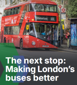
London’s buses run across almost 700 routes, with over 19,000 bus stops in the capital. Buses are one of the cheapest and most accessible ways to travel around London, but buses do not accept cash payments.
Cable Car
London Cable Car is the UK’s first urban cable car and crosses the Thames in east London between Greenwich Peninsula and Royal Docks. You can board the Cable Car from either Greenwich Peninsula or Royal Docks.
Trams
Trams run in south London, from Croydon to Wimbledon, Beckenham Junction, Elmers End and New Addington. There are connections to the Tube, London Overground, bus and National Rail services. Trams cost the same as the bus, but you cannot pay with cash.
River Bus
River Bus services operated by Uber Boat by Thames Clippers run from 23 piers along the Thames between Putney and Barking Riverside.
National Rail
Mainline trains in London are operated by different train companies including Greater Anglia, Southeastern and Thameslink. You can view and download the National Rail and TfL services map for London.
Walking and cycling
The Transport for London (TfL) website has a wide range of information about walking in London, including walking maps of central London.
There are a range of cycle hire providers operating in London, including Santander Cycles which is operated by TfL. Just go to any docking station with your bank card and touch the screen to get started. If you hire a bike regularly you can save money by registering for Santander Cycle membership.
The TfL website also contains information for cyclists including free route maps and cycle guides.
Driving in London
Congestion charge
The Congestion Charge is a £15 daily charge for driving a vehicle within the charging zone. It applies between 7am to 6pm Monday to Friday and between 12pm and 6pm on Saturdays, Sundays and Bank Holiday Mondays. It is in operation every day of the year apart from between Christmas Day and New Year’s Day (inclusive).
The easiest way to pay is by setting up Auto Pay. Exemptions and discounts are available too.
Ultra Low Emission Zone
The Ultra Low Emission Zone (ULEZ) operates 24 hours a day, 7 days a week, every day of the year except Christmas Day. Most vehicles, including cars and vans, need to meet the ULEZ emissions standards or their drivers must pay a daily charge to drive within the zone. The zone now covers all areas inside the North and South Circular Roads. The North Circular (A406) and South Circular (A205) roads are not in the zone. Check your vehicle and its charge.
Remember the Congestion Charge and the ULEZ charge are not the same charge. Many drivers have to pay both charges to drive into London.


